جمعه، آذر ۱۷، ۱۳۸۵

Benin


Facts and Figures

Official Name: Republic of Benin

Population: 6,938,700 (92 out of 192 Countries)

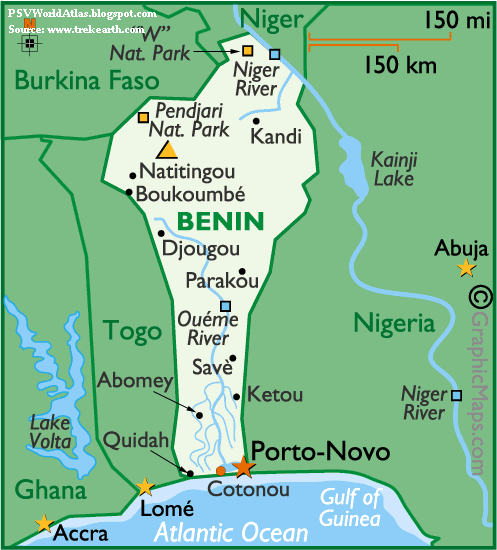
Capital City: Porto-Novo (237,000)

Largest Cities: Cotonou, Porto-Novo, Parakou

Currency: CFA Franc

Latitude/Longitude: 6°48 N, 2°63 E

Languages: French (official), tribal languages

National Day: 1 August; National Day

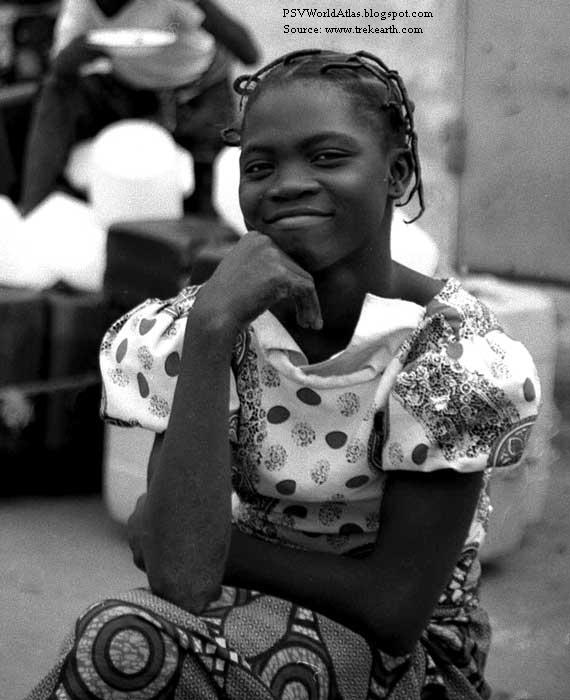
Religions: Muslim, Christian, traditional beliefs

Land

Land Area: 110,620 sq km (42,710 sq miles) (99 out of 192 Countries)

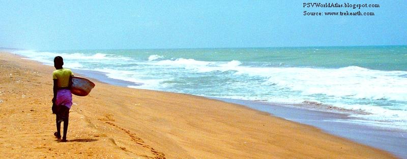
Landforms: From a narrow and somewhat sandy coastal area, the marshy land and lagoons of the south rise into the La Terre de Barre Plateau, consisting of a wooded savannah that continues on into the foot hills of the Atakora Mountains of the northwest, a branch of the Togo Mountains. From there, the land slopes down into a broad plain, and on to the Niger River valley of the far northeast. The Niger and Oueme are the country's major rivers.

Highest Point: Mt. Sokbaro (658 m) (2,158 ft)

Lowest Point: Atlantic Ocean, sea level

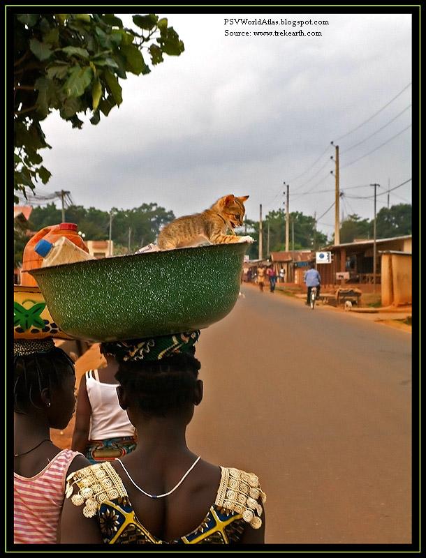
Climate: Benin is tropical; hot and humid in south; semiarid (quite dry) in north. Overall, the dry season runs from November to April, and a rainy season from the end of April through September. The mean temperature is near 80 degrees.

سه‌شنبه، آذر ۱۴، ۱۳۸۵

Belize


strong>Facts and Figures

Name: Belize

Population: 287,730

Capital City: Belmopan (52,000)

Currency: Belizean Dollar (BZD)

Languages: English (official), Spanish, Mayan, Garifuna, Creole

Religions: Catholic (50%), Protestant (27%), others

Geographic Coordinates

Latitude/Longitude (Capital City): 16° 13' N, 88° 48' W

Relative Location: Belize is positioned in both the northern and western hemispheres. Located in North America on the northern edge of the Central America isthmus - a somewhat narrow strip of land that connects North and South America - the country is bordered by Guatemala, Mexico, the Gulf of Honduras and the Caribbean Sea.

Land Statistics

Coastline: 240 miles (386 km)

Land: 8,805 sq miles (22,806 sq km)

Water: 62 sq miles (160 sq km)

TOTAL: 8,867 sq miles (22,966 sq km)

Highest Point: Victoria Peak - 3,805 ft. (1,160 m)

Lowest Point: Caribbean Sea - 0 ft. (0 m)

Climate: Belize has consistently warm and humid tropical weather with pronounced wet and dry seasons.

The rainy season typically runs (June - December) and the dry season from (January - May). Rainfall is heaviest in the coastal areas of the far south.

Average high temperatures in the coastal regions reach into the mid 70s throughout most of the year, and a bit higher inland. Much higher temperatures in the offshore islands are commonplace, with cooler conditions the norm in the mountains of the south.

Belize is occasionally the victim of the Atlantic Ocean hurricane season, and the most recent one to hit the country (Hurricane Greta) caused severe damage along the southern coastal areas in 1978.

In fact, after Hurricane Hattie devastated the central coastal area of the country in the early 1960s, the subsequent destruction of Belize City was the catalyst for the relocation of the capital to the inland city of Belmopan.

جمعه، آذر ۰۳، ۱۳۸۵

Belgium


Facts and Figures

Official Name: Kingdom of Belgium

Capital City: Brussels (1.75 million)

Latitude/Longitude: 50° 50'N, 4° 00'E

Languages: Dutch, French, German

Official Currency: the Euro

Population: 10,339,000

Religions: Catholic, Protestant

Land Area: 32,820 sq km (12,672 sq miles)

Landforms: The coastal area is a series of sandy beaches, backed by protecting dunes. Inland, up to the Meuse River, the land is generally flat, with numerous canals and dikes. It's criss-crossed by many small tributaries of the Schelde River. East of the Meuse, forested hilly conditions rise to the flat-topped mountains of the Ardennes Region. The highest point is the Botrange, at 2,276 ft. (694m).

Climate: The Gulf Stream and Atlantic Ocean winds moderate the weather in Belgium, resulting in cloudy, rainy days, especially along the coastal areas. Inland, east of the Schelde River, summers are generally mild, cloudy and cool. Winters are also mild, with frequent fog and light rain. Colder temperatures are common in the Ardennes.

چهارشنبه، آذر ۰۱، ۱۳۸۵

Bahrain


Facts and Figures

Name Bahrain (long form) Kingdom of Bahrain

Population 688,300

Capital City Manama (147,074)

Currency Bahraini Dinar (BHD)

Languages Arabic, English, Farsi, Urdu

National Day December 16

Religions Muslim (Shi'a and Sunni) (82%), Christian, others

Geographic Coordinates Latitude/Longitude (Capital City) 26˚ 13' N, 50˚ 34' E

Relative Location Bahrain is in both the northern and eastern hemispheres. It's positioned in the Middle East, a recognized geographical region of southwestern Asia. This island country is located in the Persian Gulf, directly east of Saudi Arabia.

Land Statistics Coastline 100 miles (161 km) Land Areas (land) 257 sq miles (665 sq km) (water) 0 sq miles (0 sq km) (TOTAL) 257 sq miles (665 sq km)

Landforms Bahrain is comprised of 1 large and 32 smaller islands. Almost Bahrain’s entire main island is a low-lying rocky, sandy plain. Coastal salt marshes are common, central and south. There are no significant rivers or lakes.

Highest Point Jabal ad Dukham - 400 ft. (122 m)

Lowest Point Persian Gulf - 0 ft. (0 m)

Climate Bahrain is hot and dry in the summer months, with very high humidity and no rain. Winters are mild and quite pleasant. July, August and September are the hottest months with high temps averaging near 36˚ C. Winter lows seldom fall below 13˚ C.